Victoria Asfalg
Trinity College
TEACHER'S SNAPSHOT
Course Topics/Big Ideas:
Cultural Diversity and an American National Identity, Economic Prosperity and Equity, The Struggle for Freedom, Equality, and Social Justice
Grade:
High School
Lesson Plan Notes
Zoning is the practice of designating areas of land for certain uses. Exclusionary zoning is the practice of using zoning to prevent certain groups of people from having access to certain areas. Exclusionary zoning has been used in Connecticut to develop a system of segregation within cities and between cities and their suburbs. This system has continued to exclude certain people from buying houses in certain areas as well as preventing developers from building more affordable housing options. This system, which has its origins in 1920s practices, is still in use today and can be seen by analyzing zoning maps from many suburban towns in Connecticut.
ESSENTIAL QUESTION
SUPPORTING QUESTIONS
- How do we define “zoning”?
- Why do towns use zoning?
- How can zoning affect the racial and economic composition of a town or city?
ACTIVITY
For teachers to prepare ahead: Print enough worksheets for each student to get a worksheet of their own or a worksheet for a pair of students. Students will need scissors to complete Part 1 of this activity. Note that types of buildings introduced in this activity correspond to those in zones “A”, “C”, and “E” in the historical document examined in Part 3.
Part 1: Building Homes within a Set of Rules
Start by asking some questions:
- What kind of rules are there about where and how people can live in Connecticut?
- Can you think of any ways these rules have shaped Connecticut communities?
- Can anyone define the term “zoning”?
Compile responses to revisit throughout the activity.
Show the An Introduction to Zoning video (5:57) and discuss how this relates to the questions you already discussed.
Have students complete the “Building Homes” worksheet individually or in pairs. The directions are at the top of the worksheet.
Discuss students’ answers to the worksheet questions together.
Part 2: Connecting Zoning to Today
Now that students have an idea of zoning rules, they will examine some real zoning codes and a zoning map. The zoning regulations provided here are from Norwich, Connecticut, but you can search for and use a similar document from students’ own town/region, if you prefer.
Students will work individually, in pairs, or in small groups to examine and analyze written zoning regulations and a zoning map. Note that the map is best looked at online or on computers/devices that enable them to zoom in.
Using the Library of Congress primary source analysis technique as a guide, students will OBSERVE both documents and make notes about what they see/read. Then they will REFLECT on what this means in the context of the video they watched and activity they did in Part 1. Then they will QUESTION what more these documents can tell them, what they still wonder or would like to find out more about, and where they could look for additional information.
If you would like to provide some guided questions to help students navigate the documents, you may wish to ask:
- Looking at the map legend and the “Residential Bulk Requirements” table on page 1, what does R-20 mean? How is this different from R-80?
- Which zones take up the most area in town?
- Which zones take up the least area in town?
- Are multi-family units allowed to exist in this town? If so, where can they be?
- Are apartment buildings allowed to exist in this town? If so, where?
- How might requiring more land per housing unit influence who is able to live in this town?
For an Advanced Activity: Try comparing a zoning map from a town with evidence of exclusionary zoning with a nearby town or city that is not zoned to be exclusive. Desegregate Connecticut’s “Zoning Atlas” can help you identify towns primarily zoned for single-family housing, often with requirements for large plot sizes.
Part 3: Historical Connection
Students will read excerpts (particularly pages 3 and 10) from Robert Whitten’s 1924 West Hartford Zoning report.
Using the same Library of Congress analysis techniques, students will annotate the historical document while they OBSERVE, REFLECT, and QUESTION.
Guided questions:
- What are the explicit or stated goals of this zoning proposal? What can you infer about the implicit or unstated goals?
- Define what types of structures are allowed in “Residence Districts” in your own words.
- How do zones A, B, and C differ from zones D and E?
- What do the authors mean by “zoning regulations shall be designed ‘to avoid undue concentration of population’”?
- Looking back also at what we learned in Part 2 of this activity, what are some reasons why the author may have considered multi-family zoning to be “uneconomic”?
- What is the perspective of the author? What, if any, biases can you detect?
To wrap up, revisit the compelling and supporting questions and discuss as a class what students took away from the activity and what additional questions they have.
OPPORTUNITIES FOR ASSESSMENT
- Redesign a zoning map of an existing town in Connecticut in a way that you believe would lead to greater socioeconomic integration. What would you change? What would you keep the same? Are there zones you would make smaller? Zones you would expand?
- Look up and read your town’s current zoning regulations. Write a letter to the zoning board of your town either supporting zoning as it exists today or critiquing zoning in your town. What do you feel is good about zoning in your town? What would you change?
- Design a zoning map of your own for an imaginary town that you wish to be economically and racially integrated. Use the following zoning terms: mixed use developments, residential (consider size—how many square feet?), commercial, industrial, and recreational.
- Find a current (from the past year or two) article relating to zoning in Connecticut and examine the argument being made. What is the issue at hand? What stance on the issue does the author take?
RESOURCE TOOL KIT

An Introduction to Zoning. Dave Amos for City Beautiful, 2017. (5:57)

Building Homes within a Set of Rules worksheet. Created by Victoria Asfalg, 2022.
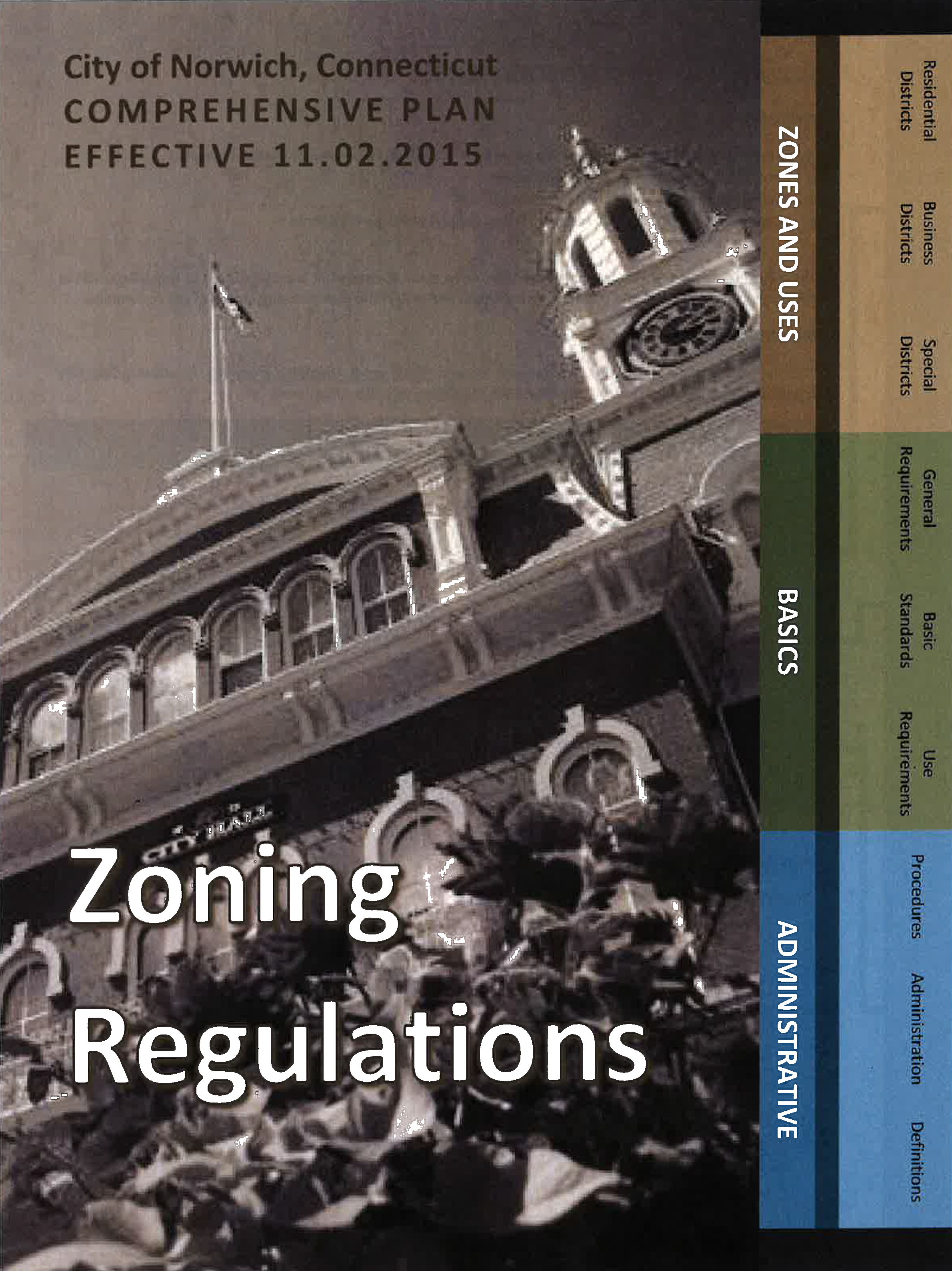
Zoning Regulations. City of Norwich, Connecticut. Effective 11.02.2015. Chapter 1: Residential Districts (Pages 1-12).
This is an example of written zoning regulation for a city in Connecticut. Note that the number after the R (ex. R-80) in the tables corresponds to the minimum land required (in thousands of square feet) for a housing structure to exist in that district.
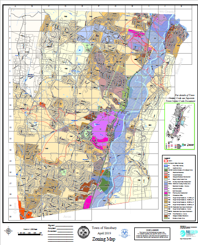
Zoning Map. Town of Simsbury, Connecticut. April 2019.
This is an example of a zoning map for a town in Connecticut. If students struggle with map skills, have them at least identify which color on the map is most predominant, then have them refer to the map legend to identify which zone is designated by that color.
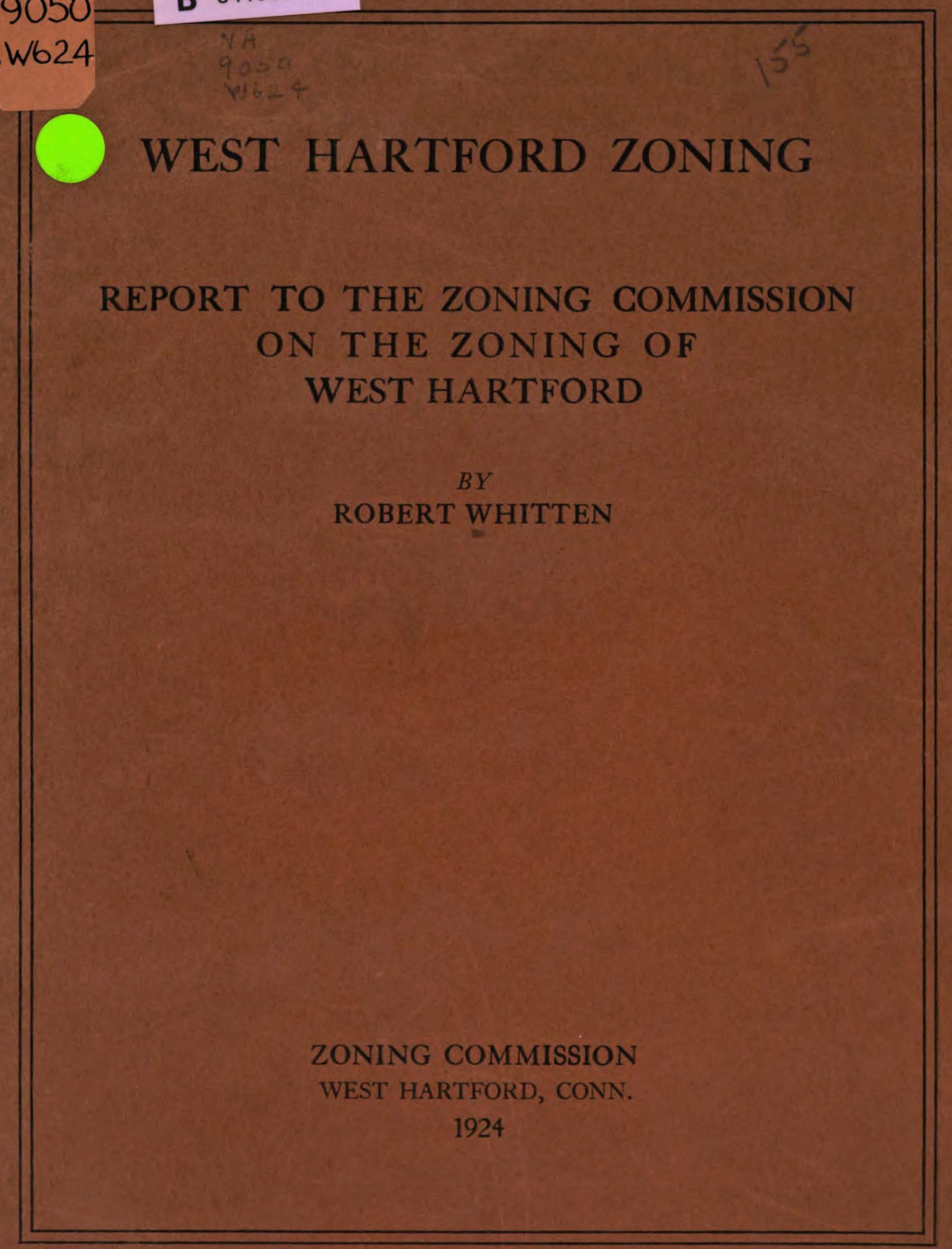
West Hartford Zoning. Robert Harvey Whitten. West Hartford CT: Zoning Commission, 1924. Pages 3, 10.
Digital version: University of Michigan, courtesy HathiTrust Digital Library.
West Hartford was the first municipality in Connecticut to introduce zoning. Robert Whitten, an urban planner who was hired to consult on the project, had previously helped create zoning codes for New York City and Atlanta.
ADDITIONAL RESOURCES
Places to GO
Make an appointment to visit your Town or City Hall to find out more about planning, zoning, and land use in your community.
Take a walking or bus tour of your town to study how zoning has shaped your community.
Things To DO
Contact someone from your local Planning and Zoning Board (it might be called something different in your town) and ask them to speak to your class about the work they do.
Look up a zoning map of your own town and find out the zoning rules for the area where you live.
Explore the “Connecticut Zoning Atlas”.
To see how one Connecticut town used local zoning regulations to fight against Nazism, check out No to Nazis in Connecticut: Southbury Takes a Stand.
Watch the video Zoning Matters: How Land-Use Policies Shape Our Lives (2:28) from the Urban Institute.
Websites to VISIT
Articles to READ
“A Jewish Grocer and the Origins of Zoning in Connecticut.” Dougherty, Jack, and contributors. On the Line: How Schooling, Housing, and Civil Rights Shaped Hartford and Its Suburbs. Trinity College, book-in-progress, 2021.
“How Zoning Can Restrict, or Even Prevent, Affordable Housing.” Booker, Christopher and Sam Weber. PBS NewsHour broadcast video, January 30, 2021.
“New study examines barriers to multifamily housing in CT towns.” Monk, Ginny. The CT Mirror, April 7, 2022.