Allison Norrie
Fairfield Public Schools
TEACHER'S SNAPSHOT
Historical Background
With the threat of nuclear war in the years after World War II, the need to move products in the name of national defense became more pressing. At the same time, the end of the war created a rise in suburban development and a subsequent spike in the need for automobiles. The Federal Highway Act of 1956, which provided large sums of state and federal highway funding, became the impetus behind urban redevelopment nationwide. Opportunistic urban planners sought to capitalize on redeveloping American cities to best suit the interests of central business districts and goods and services providers. In response to these major socio-economic shifts, President Dwight D. Eisenhower launched what was arguably the most ambitious public works project in the nation’s history: the building of the Interstate Highway System. Though Eisenhower’s vision was transformative, the project and its manifestation resulted in a number of consequences that the United States still faces today. Ultimately, tens of thousands of Americans were displaced from their properties as their homes and neighborhoods were destroyed, and many American cities are still recovering from the poor and inequitable approach to making the highways work.
D1: Potential Compelling Question
D1: POTENTIAL SUPPORTING QUESTIONS
- What does the story of highway building in New Haven tell us about the efficacy of urban renewal?
- How did citizens take public action either for or against the Interstate Highway System?
- What were the social, political, and economic ramifications of constructing the Interstate Highway System?
D2: TOOL KIT
FOR THE INTRODUCTION
Gurwitt, Rob. “Death of a Neighborhood.” Mother Jones. September/October 2000.

WTNH News8: “New Haven working to rebuild neighborhood removed by Route 34.” Oct 15, 2016. (2:07)
FOR THE ANALYSIS: AS A CLASS

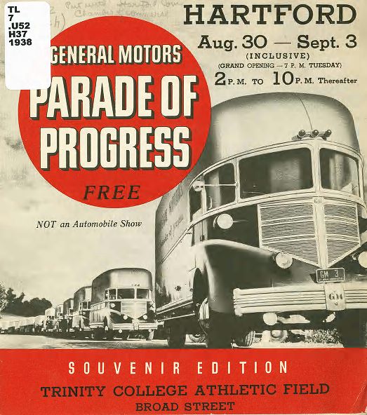
“General Motors Parade of Progress: Souvenir Edition.” 1938. Connecticut State Library.
FOR THE ANALYSIS: GROUPS 1, 2, and 3

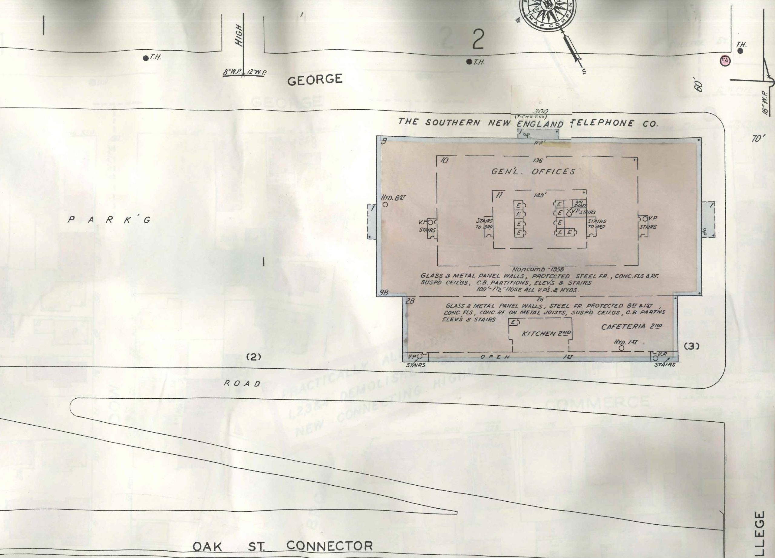
Redevelopment Agency Maps of Oak Street Connector Project. Whitney Library of the New Haven Museum.
Two “before” and two “after” maps showing two parts of the neighborhood affected by the Oak Street Connector project. On the “before” maps, the buildings indicated in pink are brick or masonry; the yellow represents wood structures. A “D” on a building indicates a dwelling; an “F” represents a flat or multi-family apartment building.
South of George Street, between Park and York Streets: Before
South of George Street, between Park and York Streets: After
South of George Street, west of College Street: Before
South of George Street, west of College Street: After
FOR THE ANALYSIS: GROUPS 1, 2, and 3

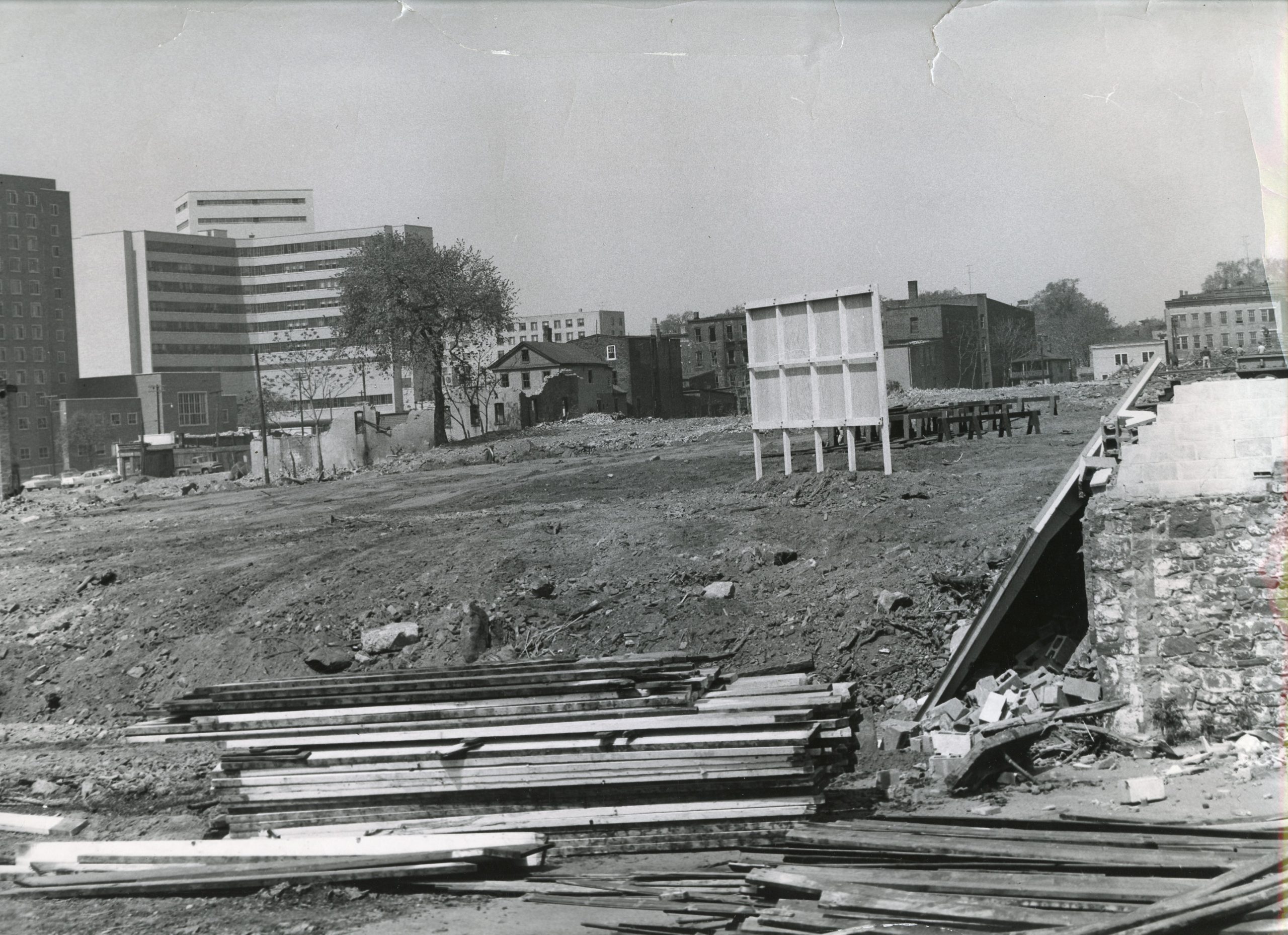
Redevelopment Agency Photographs of Oak Street Connector Project. 1956–1961. Whitney Library of the New Haven Museum.
Oak Street Neighborhood before Connector, 1956.
Oak Street Neighborhood before Connector, 1956.
Old Market, Oak Street Neighborhood before Connector, 1956.
Demolition for Oak Street Connector, 1956-57.
Completed Oak Street Connector, 1961.
FOR THE ANALYSIS: GROUP 1
Excerpt from “The Highway and the City” by Lewis Mumford (1958).
FOR THE ANALYSIS: GROUP 2
“City Clean-up Champion.” Life Magazine. Pages 87–90. February 17, 1958.
FOR THE ANALYSIS: GROUP 3
Rees, William H.H. “How We Stopped the Ring Road.” New Haven Independent. February 4, 2014.
D3: INQUIRY ACTIVITY
Introduction
- Students read this article from Mother Jones: Gurwitt, Rob. “Death of a Neighborhood.” Mother Jones. September/October 2000.
- Students will then view the Channel 8 news story exploring the effects of the New Haven highway and urban renewal projects of the 1950s and 1960s: “New Haven working to rebuild neighborhood removed by Route 34.”
- The class will engage in a group discussion about the effects the highway building and urban development of the post-war period had on American cities (specifically New Haven, Connecticut).
Part I: Analyze Sources
- Students start by examining the General Motor’s “Parade of Progress” souvenir program, with a focus on the pages dedicated to transportation. As a class, they will discuss what they feel the purpose of the publication was and the main points the authors are trying to make.
- Students will break out into small groups to examine, read, and annotate one of three sets of source material. Each group will look at the “before” and “after” maps and photographs and read one article.
- In their small groups, students will attempt to answer the supporting questions:
1. What does the story of highway building in New Haven tell us about the efficacy of urban renewal?
2. How did citizens take public action either for or against the Interstate Highway System?
3. What were the social, political, and economic ramifications of constructing the Interstate Highway System?
Part II: Share Findings
Students will share their findings and discuss the compelling question: Who decides what infrastructure is good for people?
D4: COMMUNICATING CONCLUSIONS
- Make a Public Service Announcement (PSA) Download the assignment and instructions.
- As a class, students will create a shared Google Map examining this topic. Students will break into small groups. Each group will create a “layer” on the classroom Google Map to show their work. Each group will investigate urban renewal and transportation initiatives in Connecticut. They can start by looking at the State of Connecticut’s most recent report on zoning and discrimination from 2021. Groups will be responsible for adding 3 pins to the shared Google Map to represent each project they found interesting (for a total of 3 projects). Groups will add a description and short analysis of each project to its individual pin. Find instructions for making a group map here.
ADDITIONAL RESOURCES
Place to GO
Things To DO
Get involved in urban, suburban, and rural planning initiatives with an organization like New Haven’s Urban Design League.
Get involved in a local advocacy group, such as:
Dig deeper into the history of New Haven in this period by reading The Mayor’s Game: Richard Lee of New Haven and the Politics of Change by Allan R. Talbot. New York: Harper and Row, 1967.
Read City: Urbanism and Its End. by Douglas W. Rae. Yale University, 2003.
Websites to VISIT
Highway History: U.S. Department of Transportation Federal Highway Administration
Richard Charles Lee Papers (MS 318). Manuscripts and Archives, Yale University Library. Slides, 1964 – 1965. Part of Collection — Box: 1. Call Number: MS 1803.
Articles to READ
Gurwitt, Rob. “Death of a Neighborhood.” Mother Jones. September/October 2000.
“Richard Lee’s Urban Renewal in New Haven.” ConnecticutHistory.org. July 28, 2020.
Semuels, Alana. “The Role of Highways in American Poverty.” The Atlantic. March 18, 2016.
Swaby, Aliyya. “Highway 34 Revisited.” New Haven Independent. May 13, 2016.


